
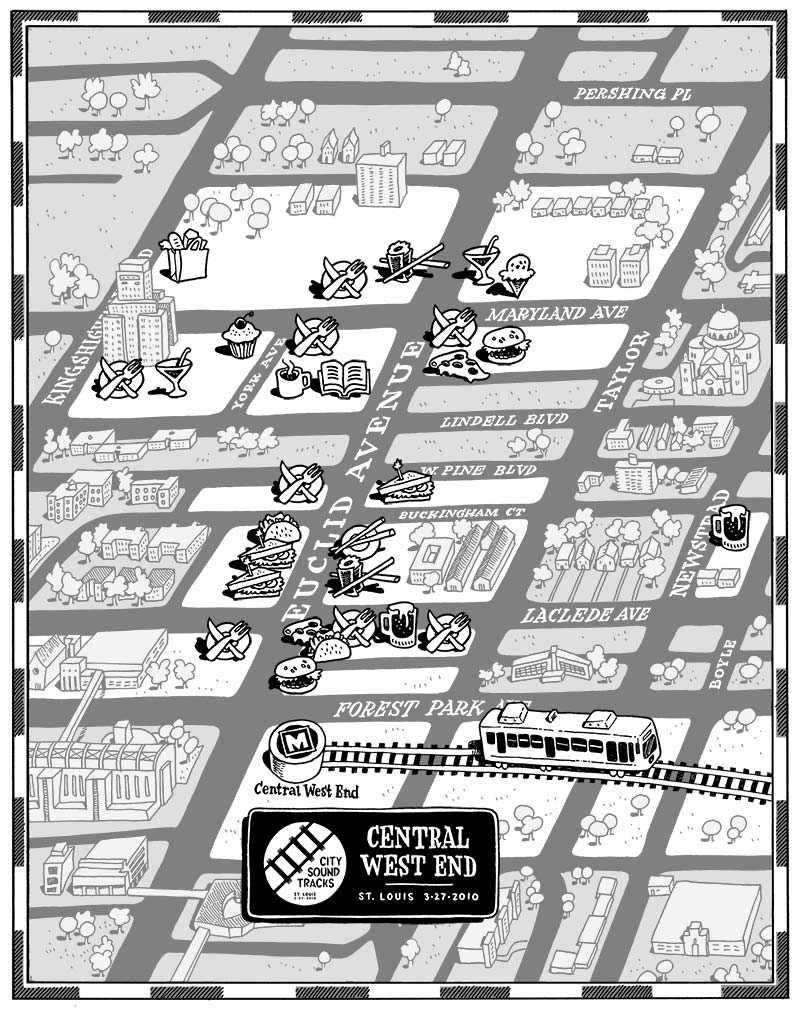
Entrepreneur, music lover, and fellow Grinnellian Alejandro Oyarzabal recently asked me to draw some maps for a rock festival happening this weekend in St. Louis. City Sound Tracks features 30 bands split between two venues along the MetroLink light rail line. The maps serve to show people how to get to the venues, and to highlight various sponsors around the area.
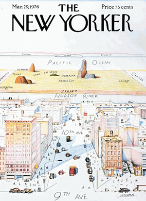
I've got to hand it to Alejandro for being courageous enough to hire me to draw a functional map -- my maps tend to be more psychological portraits of a place than actual navigable references. This New Yorker gag is the inspiration for every map I do, because it's such an honest statement about how we view the world. That is, what we know is big, and everything else is pushed off to the side:
Anyway, here are the two maps, which will be printed side-by-side on a tabloid sheet. Note that these maps are just the art files; they don't show the business names or the ad blocks. Click the maps for a larger version.
CENTRAL WEST END:
UNION STATION:
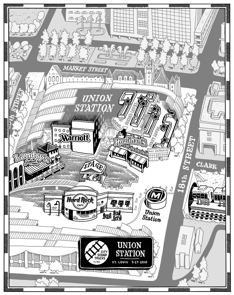
Part of the fun of this project (as well as others, like Mark McGinty's Ybor City map) is that I came into this knowing NOTHING about St. Louis aside from the arch. And now after spending hours pouring over google street view and google earth, I'm sure I would feel quite at home walking around the Central West End or downtown area.
So if you're in St. Louis this Saturday swing by one of the venues and grab a map! If you want to learn more about the festival, check out citysoundtracks.org...


1 comment:
I give these the matador salute!
OLÉ!
Post a Comment